- go undetected by the City, MNR and MVC (and MTO)?
-
go undetected by the engineering consulting firms who prepared the modelling and used its results to plan multi-millions of dollars of infrastructure and river restoration work?
Questions ... questions ...
questions???
-
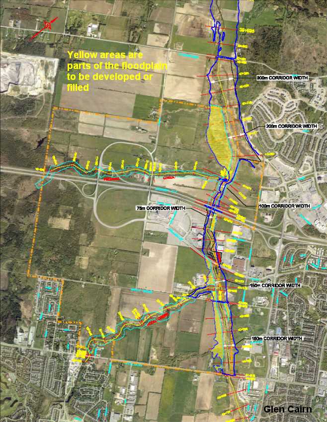
Setting aside the impugned impact assessment, is there any basis on which the City is certain it understands the existing conditions from which an impact assessment can be conducted, including establishing stormwater management criteria?
-
Who should be in charge of correcting the studies, and who should pay for the work?
-
What, if any, development in Kanata West and the Fernbank Community can proceed before the studies are corrected, approved, and a sufficient outlet in the Carp River established?
-
What can City Council do to restore the Public’s confidence in the impact assessments conducted on controversial projects?
-
What obligations does City Council have to seek answers from MTO, MNR, and MVC for their apparent lack of diligence on this project, with recommendations to ensure such a situation does not occur again?
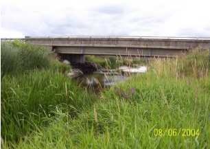
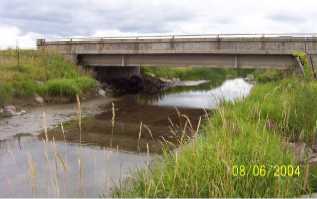
erosion/scour - 417 crossing
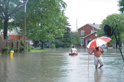
Impact on existing and future residential development
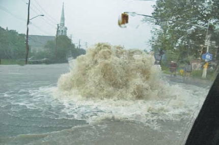
The Carp River flooded Glen Cairn in 1996 and 2002 in a failed channelization and floodplain development project just upstream of Kanata West.
While the Carp River Subwatershed Plan was underway (the Plan that recommended more channelization and floodplain development) City taxpayers had to spend $7 Million for the flood remediation project in Glen Cairn.
In 2004, on a nearby drainage system in North Kanata, dozens of homes and a nursing home were flooded by raw sewage when a floodplain development project on the Kizell Drain failed and over-topped its banks and flooded the March Pump Station.From MOE letter to City, August 2005
... "I have a low degree of confidence in the Carp River flows forecasted for different return periods: some tables of the CRWSS identify post development flows at levels significantly lower than the ones established in 1983 by Cumming Cockburn limited. The uncertainty associated with the flow forecasting is further compounded with the floodplain delineation because I'm not convinced that the calibration of the Carp River water surface profile model was achieved and thus, water levels for future development conditions would be underestimated."
| Kanata West Owners Group Consultants
"misplace" runoff volume The proponents who are advocating in favour of the floodplain development failed to include in their impact assessment any of the runoff volume that will be generated from the 700 Ha Kanata West development area. Though this area has been studied for several years there still remains insufficient stream flow data to calibrate or "truth" the modelling - modelling on which the design of millions of dollars of infrastructure and river restoration work depends. Why wasn't adequate stream flow monitoring planned for and collected? |
City, residents sue over sewage flood in Kanata North homes
CBC News
Lawsuits are flowing out of a storm that pumped raw sewage into 44 homes in Ottawa's Kanata North neighbourhood two years ago.
Residents are suing the City of Ottawa, which they
blame for
approving a development called Marshes Village on a nearby flood
plain close to Shirley's Bay on the Ottawa River.
Wetlands
and floodplains are long-term assets more important than for development
- protects carbon sinks - the destruction of wetlands releases large amounts of carbon dioxide, methane and nitrous oxides
- protects groundwater recharge areas and stream headwaters
- provides water for a warming climate
- protects biodiversity as climate change places added pressure on the flora and fauna
- provides space for increasing the forest cover
- provides flood control from severe weather events